Stunning Google Earth photos show our planet changing
Google (s GOOG), along with the US Geological Survey, NASA and TIME, has shared a quarter-century of photos taken from space that show the surface of the earth and the changes that have happened over that period. From Google’s blogpost:
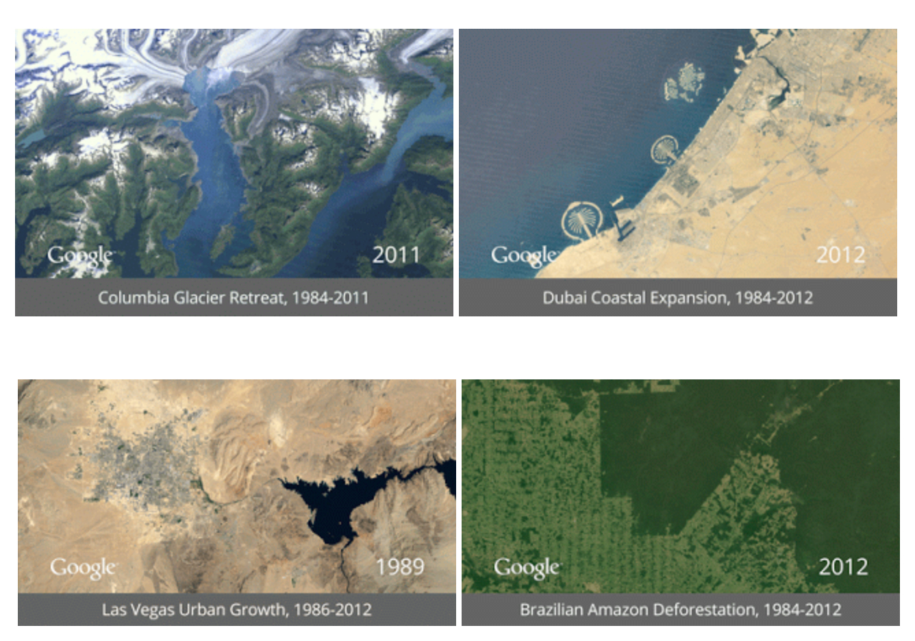
We started working with the USGS in 2009 to make this historic archive of earth imagery available online. Using Google Earth Engine technology, we sifted through 2,068,467 images—a total of 909 terabytes of data—to find the highest-quality pixels (e.g., those without clouds), for every year since 1984 and for every spot on Earth. We then compiled these into enormous planetary images, 1.78 terapixels each, one for each year.
The changes on our planet are stunning. A glacier has almost vanished, a new city has been created and the Amazon rainforest has been decimated. Our capability as humans to destroy our planet and re-create it is astonishing. The whole project makes you realize that in order to understand something important and profound, you have to look at it over a period of time.
Check it out on Google’s Timelapse website.
Perhaps Google will finally stir the developed world into action to save our planet. My personal goal is to help stop a stunning plan to build massive tunnels under the California Delta in order to ship water to corporate agriculture in Southern California. This plan is so crazy it is hard to believe that anyone could support it. But Governor Jerry Brown does and his administration would like to slip this project through before the Bay Area catches on. http://www.restorethedelta.org for the facts.
Pretty cool.
Space time, what can I say.
Amazing, isn’t it? And more than a little frightening.